[Sample Post] Computer Vision in Autonomous Vehicles The Eyes of Self-Driving Technology
Computer vision represents the critical sensory system that enables autonomous vehicles to perceive and understand their environment with human-like—and often superhuman—capability. This technology transforms raw visual data from cameras into actionable intelligence, allowing self-driving cars to detect objects, predict movements, and make split-second decisions that ensure passenger safety and efficient navigation.
The complexity of autonomous vehicle perception extends far beyond simple object detection. These systems must simultaneously track multiple dynamic objects, understand three-dimensional spatial relationships, predict future movements, and adapt to varying weather and lighting conditions—all while processing information at speeds that enable real-time decision making. The integration of computer vision with other sensing modalities creates a comprehensive understanding of the vehicle's environment that surpasses human perception in many scenarios.
Vision-Based Perception Systems
Camera Technologies and Configurations
Modern autonomous vehicles employ multiple camera systems strategically positioned to provide comprehensive 360-degree coverage around the vehicle.
Camera Types and Specifications:
- Forward-facing cameras: High-resolution (2-8MP) for long-range object detection
- Wide-angle cameras: 120-180° field of view for intersection monitoring
- Stereo cameras: Dual-lens systems for depth perception
- Infrared cameras: Thermal imaging for low-visibility conditions
- Fish-eye cameras: Ultra-wide 190° view for parking and maneuvering
Multi-Camera Fusion Architecture:
Camera Position | Primary Function | Field of View | Resolution |
|---|---|---|---|
Front Center | Long-range detection, traffic sign reading | 50° | 8MP |
Front Wide | Intersection monitoring, pedestrian detection | 120° | 2MP |
Side Mirrors | Blind spot monitoring, lane changes | 80° | 2MP |
Rear | Parking assistance, following vehicles | 130° | 2MP |
Interior | Driver monitoring (Level 3 systems) | 60° | 1MP |
Image Processing Capabilities:
- Frame Rate: 30-60 FPS for real-time processing
- Dynamic Range: High Dynamic Range (HDR) for varying light conditions
- Color Depth: 12-bit color processing for accurate object recognition
- Low-Light Performance: Enhanced sensitivity for night driving
Sensor Fusion Integration
Computer vision systems work in conjunction with other sensors to create a comprehensive perception model.
LiDAR and Camera Fusion:
- Complementary Strengths: LiDAR provides precise distance, cameras provide rich semantic information
- Calibration Requirements: Precise alignment between sensor coordinate systems
- Data Association: Matching objects detected by different sensors
- Confidence Weighting: Using sensor reliability for decision making
Radar Integration:
- Weather Robustness: Radar performance in rain, snow, and fog
- Velocity Measurements: Direct measurement of object speeds
- Long-Range Detection: Extended range for highway driving
- Penetration Capability: Detection through vegetation and other obstacles
Ultrasonic Sensors:
- Close-Range Precision: Parking and low-speed maneuvering
- Cost-Effective: Simple sensors for basic distance measurement
- Backup Systems: Redundancy for critical safety functions
- Environmental Robustness: Reliable performance in various weather conditions
Object Detection and Classification
Advanced object detection systems must identify and classify hundreds of different object types in real-time while maintaining extremely high accuracy rates.
Deep Learning Architectures
Convolutional Neural Networks (CNNs):Modern autonomous vehicles employ sophisticated CNN architectures optimized for automotive applications:
YOLO (You Only Look Once) Family:
- Real-time Performance: Single-pass detection with minimal latency
- Multi-scale Detection: Identifying objects at various sizes
- Grid-based Approach: Dividing images into detection grids
- Automotive Optimization: Custom training for vehicle-specific scenarios
Region-based CNNs (R-CNN):
- Two-stage Detection: Region proposal followed by classification
- High Accuracy: Superior precision for critical safety applications
- Feature Sharing: Efficient computation through shared features
- Mask R-CNN: Pixel-level segmentation for precise object boundaries
Single Shot Detectors (SSD):
- Speed Optimization: Fast inference for real-time applications
- Multi-scale Features: Detection at multiple resolution levels
- Default Boxes: Predefined anchor boxes for various object shapes
- Mobile Optimization: Efficient architectures for edge computing
Transformer-based Models:
- DETR (Detection Transformer): End-to-end object detection without anchors
- Vision Transformer (ViT): Attention-based feature extraction
- Global Context: Understanding relationships between distant objects
- Scalability: Better performance with larger datasets
Object Classification Categories
Vehicle Detection:
- Car Types: Sedans, SUVs, trucks, motorcycles, buses
- Vehicle States: Parked, moving, turning, braking, accelerating
- Emergency Vehicles: Police, ambulance, fire trucks with special behaviors
- Commercial Vehicles: Delivery trucks, construction vehicles, agricultural equipment
Pedestrian and Cyclist Detection:
- Human Pose Estimation: Understanding body positioning and movement
- Activity Recognition: Walking, running, crossing streets, waiting
- Age and Vulnerability: Children, elderly, disabled individuals
- Cyclist Behavior: Direction of travel, signaling, group riding
Infrastructure Recognition:
- Traffic Signs: Speed limits, stop signs, yield signs, regulatory signs
- Traffic Lights: Color recognition, arrow directions, pedestrian signals
- Road Markings: Lane lines, crosswalks, symbols, text
- Road Surface: Construction zones, potholes, debris, wet/icy conditions
Environmental Objects:
- Barriers: Concrete barriers, guardrails, jersey barriers
- Natural Objects: Trees, rocks, animals crossing roads
- Weather Effects: Rain, snow, fog, sun glare
- Dynamic Objects: Flying debris, falling objects, temporary obstacles
Real-time Processing Requirements
Latency Constraints:
- End-to-end Latency: <100ms from image capture to decision output
- Processing Pipeline: Image acquisition, preprocessing, inference, post-processing
- Parallel Processing: Multiple object types detected simultaneously
- Prioritization: Critical safety objects processed first
Computational Architecture:
- Edge Computing: On-vehicle processing for minimal latency
- GPU Acceleration: Specialized hardware for parallel neural network inference
- Dedicated AI Chips: Custom silicon optimized for automotive AI workloads
- Redundant Systems: Backup processing units for safety-critical functions
Performance Optimization:
- Model Quantization: Reduced precision arithmetic for faster inference
- Pruning: Removing unnecessary network parameters
- Knowledge Distillation: Training smaller models from larger teacher networks
- Hardware-Software Co-design: Optimizing algorithms for specific processors
Depth Estimation and 3D Understanding
Three-dimensional understanding of the environment is crucial for safe autonomous navigation, requiring sophisticated techniques to extract spatial information from visual data.
Stereo Vision Systems
Binocular Stereo:
- Disparity Calculation: Measuring pixel differences between left and right images
- Triangulation: Computing 3D positions from disparity maps
- Calibration Requirements: Precise geometric calibration of camera pairs
- Baseline Optimization: Camera separation distance affecting depth accuracy
Stereo Matching Algorithms:
- Block Matching: Comparing image patches between stereo pairs
- Semi-Global Matching: Optimizing disparity across multiple paths
- Deep Learning Stereo: CNN-based disparity estimation
- Real-time Optimization: Fast algorithms suitable for automotive applications
Depth Map Quality:
Distance Range | Accuracy | Applications |
|---|---|---|
0-10m | ±5cm | Parking, collision avoidance |
10-50m | ±20cm | Urban navigation, object tracking |
50-100m | ±1m | Highway driving, following distance |
>100m | ±5m | Long-range planning, traffic analysis |
Monocular Depth Estimation
Deep Learning Approaches:Single-camera depth estimation using neural networks:
Supervised Learning:
- Ground Truth Training: Using LiDAR data for depth supervision
- Multi-scale Networks: Predicting depth at multiple resolutions
- Attention Mechanisms: Focusing on depth-critical image regions
- Loss Functions: Specialized losses for depth prediction accuracy
Self-supervised Learning:
- Photometric Consistency: Using temporal consistency for supervision
- Stereo Supervision: Learning from stereo pairs without ground truth
- Motion Parallax: Exploiting vehicle motion for depth cues
- Adversarial Training: Improving realism of depth predictions
Geometric Constraints:
- Perspective Geometry: Understanding vanishing points and horizon lines
- Ground Plane Estimation: Identifying road surface for object height calculation
- Camera Motion: Compensating for vehicle movement in depth estimation
- Scale Recovery: Resolving inherent scale ambiguity in monocular vision
3D Object Reconstruction
Voxel-based Representations:
- 3D Grid Structures: Representing space as discrete 3D cells
- Occupancy Grids: Binary classification of space occupancy
- Multi-resolution Grids: Hierarchical representation for efficiency
- Dynamic Updates: Real-time modification based on new observations
Point Cloud Processing:
- Sparse Representations: Efficient storage of 3D information
- Feature Extraction: Identifying key 3D characteristics of objects
- Clustering: Grouping points belonging to same objects
- Surface Reconstruction: Generating smooth object surfaces
Mesh Generation:
- Polygonal Models: Representing objects as connected triangles
- Level of Detail: Varying mesh complexity based on importance
- Texture Mapping: Applying visual appearance to 3D models
- Real-time Rendering: Efficient visualization of 3D scene understanding
Path Planning and Navigation
Computer vision provides essential input for path planning algorithms, enabling autonomous vehicles to navigate safely through complex environments.
Lane Detection and Road Understanding
Lane Marking Detection:
- Edge Detection: Identifying lane boundary edges in images
- Hough Transform: Detecting straight and curved lane lines
- Deep Learning Approaches: CNN-based lane segmentation
- Temporal Consistency: Tracking lanes across multiple frames
Road Geometry Understanding:
- Curvature Estimation: Measuring road curvature for path planning
- Banking Angle: Understanding road tilt for vehicle dynamics
- Width Calculation: Measuring available lane width
- Merge/Split Detection: Identifying lane changes and highway interchanges
Drivable Area Segmentation:
- Semantic Segmentation: Pixel-level classification of drivable regions
- Free Space Detection: Identifying areas clear of obstacles
- Construction Zone Handling: Adapting to temporary lane configurations
- Parking Lot Navigation: Understanding complex parking environments
Obstacle Avoidance
Dynamic Object Tracking:
- Multi-object Tracking: Simultaneously tracking multiple moving objects
- Kalman Filters: Predicting object positions and velocities
- Data Association: Matching detections across frames
- Occlusion Handling: Tracking objects partially hidden by others
Trajectory Prediction:
- Motion Models: Predicting future positions of moving objects
- Intention Recognition: Understanding likely actions of other road users
- Interaction Modeling: Predicting responses to autonomous vehicle actions
- Uncertainty Quantification: Estimating confidence in predictions
Collision Risk Assessment:
- Time to Collision (TTC): Calculating collision risk metrics
- Safety Margins: Maintaining appropriate following distances
- Emergency Braking: Triggering automatic emergency responses
- Path Replanning: Dynamically adjusting routes to avoid hazards
High-Definition Mapping Integration
Localization Accuracy:
- Visual Odometry: Estimating vehicle motion from camera data
- Feature Matching: Comparing observed features with map data
- Loop Closure: Correcting drift in long-term navigation
- Centimeter-level Accuracy: Precise positioning for lane-level navigation
Map-based Planning:
- Prior Knowledge: Utilizing detailed map information for planning
- Lane-level Routing: Planning at individual lane granularity
- Traffic Rule Understanding: Incorporating regulatory information
- Construction Updates: Adapting to temporary map changes
Dynamic Map Updates:
- Real-time Changes: Detecting and reporting map discrepancies
- Crowdsourced Updates: Aggregating information from multiple vehicles
- Verification Systems: Ensuring accuracy of map modifications
- Version Control: Managing map updates across vehicle fleets
Environmental Challenges
Weather and Lighting Conditions
Rain and Wet Roads:
- Reflection Handling: Managing reflections on wet pavement
- Windshield Interference: Compensating for water droplets
- Visibility Reduction: Adapting to reduced visual range
- Hydroplaning Detection: Identifying dangerous road conditions
Snow and Ice Conditions:
- Lane Marking Obscuration: Detecting buried lane markings
- Texture Analysis: Identifying icy or snowy road surfaces
- Visibility Challenges: Operating in reduced visibility conditions
- Thermal Imaging: Using infrared cameras for improved detection
Sun Glare and Backlighting:
- Dynamic Range: Handling extreme brightness variations
- Lens Flare: Mitigating optical artifacts
- Shadow Adaptation: Adjusting to rapidly changing light conditions
- Polarization Filters: Hardware solutions for glare reduction
Night Driving:
- Low-light Enhancement: Amplifying available light for detection
- Headlight Optimization: Using vehicle lighting for improved visibility
- Infrared Integration: Combining thermal and visible spectrum data
- Retroreflective Detection: Utilizing reflective materials for object detection
Urban Complexity
Dense Traffic Scenarios:
- Multi-lane Tracking: Managing complex multi-vehicle scenarios
- Intersection Navigation: Understanding right-of-way and traffic flows
- Pedestrian Crowds: Detecting and predicting crowd movements
- Emergency Vehicle Response: Appropriately yielding to emergency services
Construction and Work Zones:
- Temporary Signage: Recognizing non-standard signs and markings
- Personnel Detection: Identifying construction workers and flaggers
- Equipment Recognition: Detecting construction vehicles and machinery
- Route Adaptation: Navigating through modified traffic patterns
Parking and Maneuvering:
- Space Detection: Identifying available parking spaces
- Multi-point Turns: Executing complex maneuvering sequences
- Proximity Sensing: High-precision distance measurement for tight spaces
- Damage Prevention: Avoiding contact with nearby objects
Safety and Reliability
Safety-critical applications in autonomous vehicles require unprecedented levels of reliability and fail-safe operation.
Functional Safety Standards
ISO 26262 Compliance:
- Automotive Safety Integrity Levels (ASIL): Risk classification from A to D
- Hazard Analysis: Systematic identification of potential failures
- Safety Goals: Defining acceptable risk levels
- Verification and Validation: Proving system meets safety requirements
Safety Architecture:
- Redundant Systems: Multiple independent perception systems
- Diverse Technologies: Using different sensor types for cross-validation
- Graceful Degradation: Maintaining basic functionality during partial failures
- Safe States: Defined behaviors when systems cannot operate normally
Testing and Validation:
- Simulation Testing: Millions of virtual miles in simulated environments
- Closed-course Testing: Controlled testing of specific scenarios
- Public Road Testing: Real-world validation with safety drivers
- Statistical Validation: Demonstrating safety through extensive data collection
Failure Mode Analysis
Sensor Failures:
- Camera Occlusion: Lens obstruction by dirt, snow, or damage
- Lighting Failures: Inadequate illumination for image capture
- Hardware Malfunctions: Electronic component failures
- Calibration Drift: Gradual degradation in sensor accuracy
Processing Failures:
- Compute Overload: Insufficient processing power for real-time operation
- Software Bugs: Errors in perception or decision-making algorithms
- Memory Errors: Data corruption affecting system operation
- Communication Failures: Loss of data between system components
Environmental Challenges:
- Extreme Weather: Conditions beyond design specifications
- Novel Scenarios: Situations not represented in training data
- Adversarial Conditions: Intentional attempts to fool perception systems
- Infrastructure Changes: Unexpected modifications to road environment
Edge Cases and Corner Cases
Rare but Critical Scenarios:
- Emergency Vehicle Responses: Unusual lighting patterns and behaviors
- Construction Equipment: Non-standard vehicles in roadway
- Animal Encounters: Wildlife crossing roads unexpectedly
- Debris and Objects: Unusual objects in roadway
Handling Unknown Situations:
- Uncertainty Quantification: Measuring confidence in perception results
- Conservative Behavior: Defaulting to safe actions when uncertain
- Human Handoff: Transitioning control to human drivers when needed
- Continuous Learning: Updating systems based on new scenarios
Current Industry Implementations
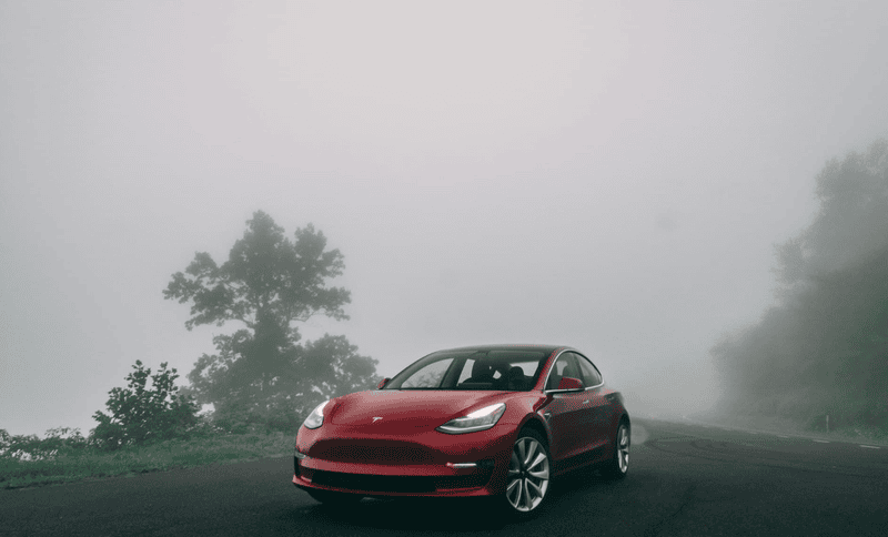
Tesla Autopilot and Full Self-Driving
Vision-Only Approach:
- Neural Network Architecture: Custom-designed networks for automotive applications
- Multi-camera System: 8 cameras providing 360-degree coverage
- In-house Processing: Custom AI chips for efficient inference
- Over-the-air Updates: Continuous improvement through software updates
Data Collection Strategy:
- Shadow Mode: Collecting data from all vehicles for training
- Fleet Learning: Aggregating experiences across millions of vehicles
- Edge Case Mining: Identifying unusual scenarios for targeted training
- Simulation Integration: Combining real-world data with synthetic scenarios
Waymo's Multi-modal Approach
Sensor Fusion Strategy:
- LiDAR-centric Design: High-resolution 3D mapping with LiDAR
- Camera Integration: Rich semantic information from vision systems
- Radar Supplementation: Weather-robust detection capabilities
- Ultrasonic Backup: Close-range precision for parking
Operational Design Domain:
- Geofenced Operation: Limited to well-mapped urban areas
- High-definition Maps: Detailed prior knowledge of operating environment
- Remote Monitoring: Human oversight for complex scenarios
- Gradual Expansion: Systematic expansion of service areas
Traditional Automotive Approaches
Tier 1 Supplier Integration:
- Bosch: ADAS systems with step-wise automation increase
- Continental: Integrated camera and sensor systems
- Mobileye: Computer vision specialized for automotive applications
- Magna: Complete system integration for OEMs
OEM Strategies:
- Mercedes-Benz: DRIVE PILOT Level 3 system for highway driving
- BMW: iDrive system with increasing automation capabilities
- Toyota: Guardian system emphasizing human-AI collaboration
- General Motors: Super Cruise highway automation system
Future Developments
Next-Generation Technologies
Neuromorphic Computing:
- Event-based Cameras: Mimicking human vision processing
- Spiking Neural Networks: Brain-inspired processing architectures
- Ultra-low Latency: Near-instantaneous response to visual events
- Power Efficiency: Dramatically reduced energy consumption
Quantum Computing Applications:
- Optimization Problems: Route planning and resource allocation
- Machine Learning: Quantum-enhanced neural networks
- Cryptographic Security: Secure communication between vehicles
- Simulation Capabilities: Quantum simulation of complex scenarios
Edge AI Integration:
- Distributed Processing: Sharing computation across multiple vehicles
- V2X Communication: Vehicle-to-everything data sharing
- Collective Intelligence: Learning from fleet experiences
- Real-time Collaboration: Coordinated behavior in traffic scenarios
Autonomous Vehicle Levels
Level 3 (Conditional Automation):
- Human Oversight: Driver must be ready to take control
- Limited Conditions: Operating only in specific scenarios
- Attention Monitoring: Systems to ensure driver readiness
- Legal Framework: Regulatory approval for specific use cases
Level 4 (High Automation):
- No Human Required: System handles all driving tasks in defined areas
- Operational Design Domain: Limited geographic or scenario scope
- Remote Monitoring: Possible human oversight from operations centers
- Commercial Deployment: Ride-sharing and delivery applications
Level 5 (Full Automation):
- Universal Operation: Functioning in all driving scenarios
- No Human Interface: No steering wheel or pedals required
- Complete Autonomy: Independent operation without any human involvement
- Regulatory Challenges: Comprehensive legal and safety frameworks needed
Conclusion
Computer vision technology represents the cornerstone of autonomous vehicle development, providing the sophisticated perception capabilities necessary for safe and efficient self-driving operation. The integration of advanced deep learning algorithms, high-resolution sensor systems, and real-time processing architectures has created vision systems that can match and exceed human visual capabilities in many driving scenarios.
The continued advancement of computer vision in autonomous vehicles will be driven by improvements in neural network architectures, sensor technologies, and processing capabilities. As these systems become more robust and reliable, they will enable increasingly sophisticated autonomous behaviors and broader deployment scenarios.
The future of transportation will be fundamentally shaped by the continued evolution of computer vision technology. The systems being developed today are laying the groundwork for a transportation ecosystem that is safer, more efficient, and more accessible than ever before. Success in this domain requires continued collaboration between technology companies, automotive manufacturers, regulatory bodies, and society as a whole.
The vision of fully autonomous vehicles navigating safely through any environment represents one of the most challenging applications of artificial intelligence and computer vision. As these technologies continue to mature, they promise to transform not just how we travel, but how our cities and societies are organized around mobility and transportation.